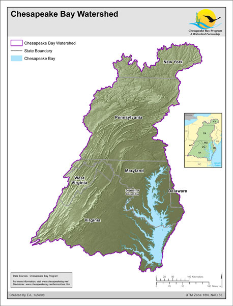
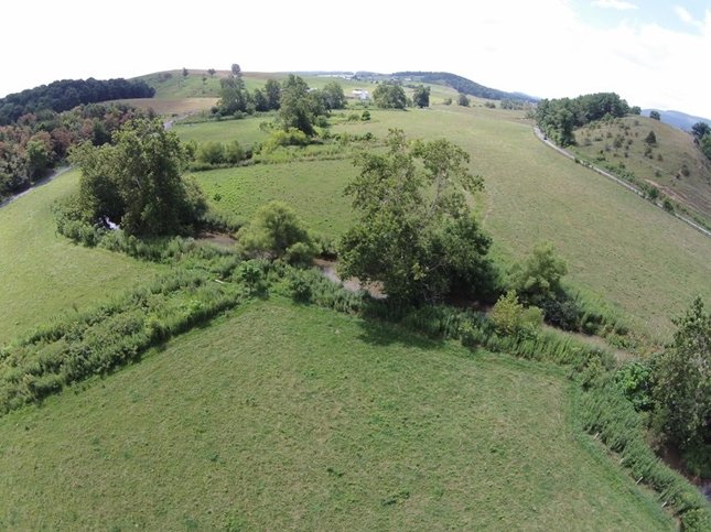
 --submitted by by Bobby Whitescarver (originally published in slightly different form here.) The Chesapeake Clean Water Blueprint is working to reduce sedimentation and agricultural runoff into streams, make nutrient management simpler and more effective, verify land uses and cover crops via remote sensing, and invest in establishing and maintaining streamside buffers. Lesson 1. The Chesapeake Clean Water Blueprint is working Our number one lesson is that the Chesapeake Clean Water Blueprint is working. Water quality in the Bay is improving. We have reduced nutrients in the Bay in half since 1983; despite the fact our population as increased 30%. That is quite an achievement. There are many reasons for this. Waste water treatment, application of Best Management Practices (BMPs) on farmland, oyster restoration, air pollution reduction, reductions in phosphorus from laundry detergent and lawn fertilizers, people doing their part . . . I could go on and on. The river that flows through my farm is a TMDL stream (i.e., subject to Total Maximum Daily Loads regulations for polluted streams), and we are in the designated Chesapeake Bay TMDL as well. These designations have brought water pollution and sedimentation control and reduction program funds into our watershed that help farmers install needed BMPs like cover crops, crop rotation to perennials and riparian buffers. Because of these programs our farm now produces food and clean water; something we are very proud of. These programs created jobs for fence builders, tree planters, and other contractors. . . . Those of us in the environmental community think our progress is woefully slow, but the fact is, we are and have been improving the streams and waterways of the Bay steadily and slowly ever since we started the journey in the late 60s. Below I offer additional lessons that I think we in the Chesapeake Bay watershed could improve on, and which may improve strategies applied in other watersheds. Lesson 2. Make nutrient management simpler Chesapeake farmers have greatly improved the use of nutrients on their land and we have developed programs to transport poultry litter from areas with too much of it to areas that need it as fertilizer. But when it comes to phosphorous (P), it’s gotten too complicated and we have not done enough. We have built billion dollar nutrient management bureaucracies, created phosphorous indexes and management tools that hardly anyone understands, and cut down millions of trees to produce plans that few farmers use. Putting research dollars into figuring out how we can keep applying phosphorus to soils already saturated with it is a waste of time and money that avoids the inevitable: if the soil is saturated with P, don’t apply anymore; Period, with a capital P. We should invest program dollars in bigger and better P (manure) transport to areas that need it. Phosphorus is a macronutrient in great demand. There are more acres of farmland that need P than ones that have too much. We also need to begin using crops to remove P from soils saturated with it. Call it agronomic phosphorus extraction from soils or APES for short. (What an acronym? !.) Many say this form of P extraction from the soil, using crops, would take 30 to 100 years. Okay, when do we start? Or do we just keep adding phosphorus at crop uptake levels? Lesson 3. Cover crops work, but we must make verification simpler Farmers in the Chesapeake Bay watershed are planting cover crops like nowhere else. In most areas in Virginia for example, cover crop acres reach 90% of row-crop acres. This is wonderful and reduces both soil erosion and nutrient runoff. Sadly, I was told that the best cover crop county in the Great Lakes region is at best 5%. Virginia’s cover crop program is a huge success but wastes money in verification that we’ve made to too complicated. To verify that a farmer has planted a cover crop in Virginia’s cost share program a government employee has to drive around in their government vehicles to verify when the crop was planted and if and when the crop was harvested or killed. The programs even dictate what seeds the farmer can use as a cover crop. Most, if not all of this “on the ground” verification could be done via remote sensing, saving a lot of time and money. To streamline the process, just let farmers know that their row-crop acres need to be 100% covered by December 1st. Farmers, I guarantee, will figure out how to get there. We don’t need to dictate what seeds they use, or when they have to plant it. Lesson 4. Riparian forest buffers work but need maintenance
Streams flowing through a forest buffer are two to eight times more capable of processing in-stream pollutants than streams flowing through grassed buffers. That’s because leaves from native trees feed the bugs that eat the pollution. This empirical data comes to us from the Stroud Water Research Center. Investing in trees along streams makes sense, and Chesapeake farmers have planted thousands of acres of riparian forest buffers. To ensure success and improve the marketability of these nutrient-filtering carbon sinks, we need to invest more in maintaining these areas. One can’t just plant the trees and walk away expecting a healthy forest in ten years. A Regional TMDL is working in the Chesapeake Bay Watershed; it can work in other watersheds The Chesapeake Clean Water Blueprint is working. The Bay is getting better and so are the streams that feed it. People living in other watersheds are in great need of improved nutrient management, cover crops, and forest buffers. They can look to the Chesapeake Bay watershed for a path forward. Bobby Whitescarver is a farmer, conservationist, educator, and writer. He can be reached through his website: www.gettingmoreontheground.com
1 Comment
|
When we see land as a community to which we belong, we may begin to use it with love and respect.... Conservation, viewed in its entirety, is the slow and laborious unfolding of a new relationship between people and land." There is in fact no distinction between the fate of the land and the fate of the people. When one is abused, the other suffers. From the PresidentSCP President Chuck Roe looked at land conservation along the route of John Muir's "Southern Trek." About ViewpointThis blog offers views of our Board and partners. We invite your viewpoint on the following questions: Archives
April 2024
Categories
All
|


 RSS Feed